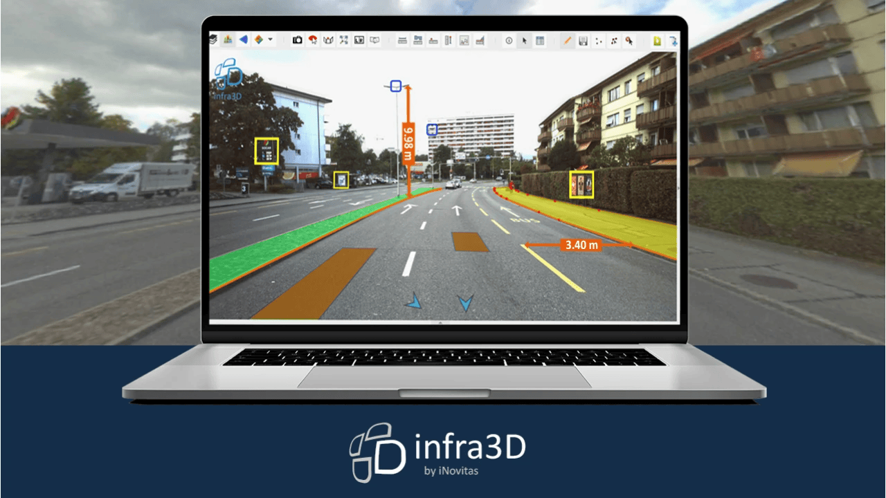
The smart and cloud-based infra3D solution from iNovitas AG with its products and applications enables efficient management, planning and visualisation of the infrastructure. This brings the road and rail directly to the user's workplace in high-resolution and three-dimensional form.
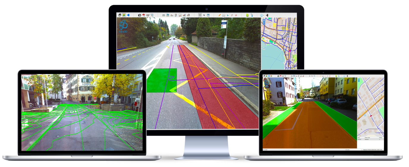
infra3D supports you and your organisation in the management and documentation of your road and rail space. Your roads are available web-based as intelligent 3D images, 3D point clouds and playable image sequences. With the comprehensive infra3D functions, various applications are open to you:
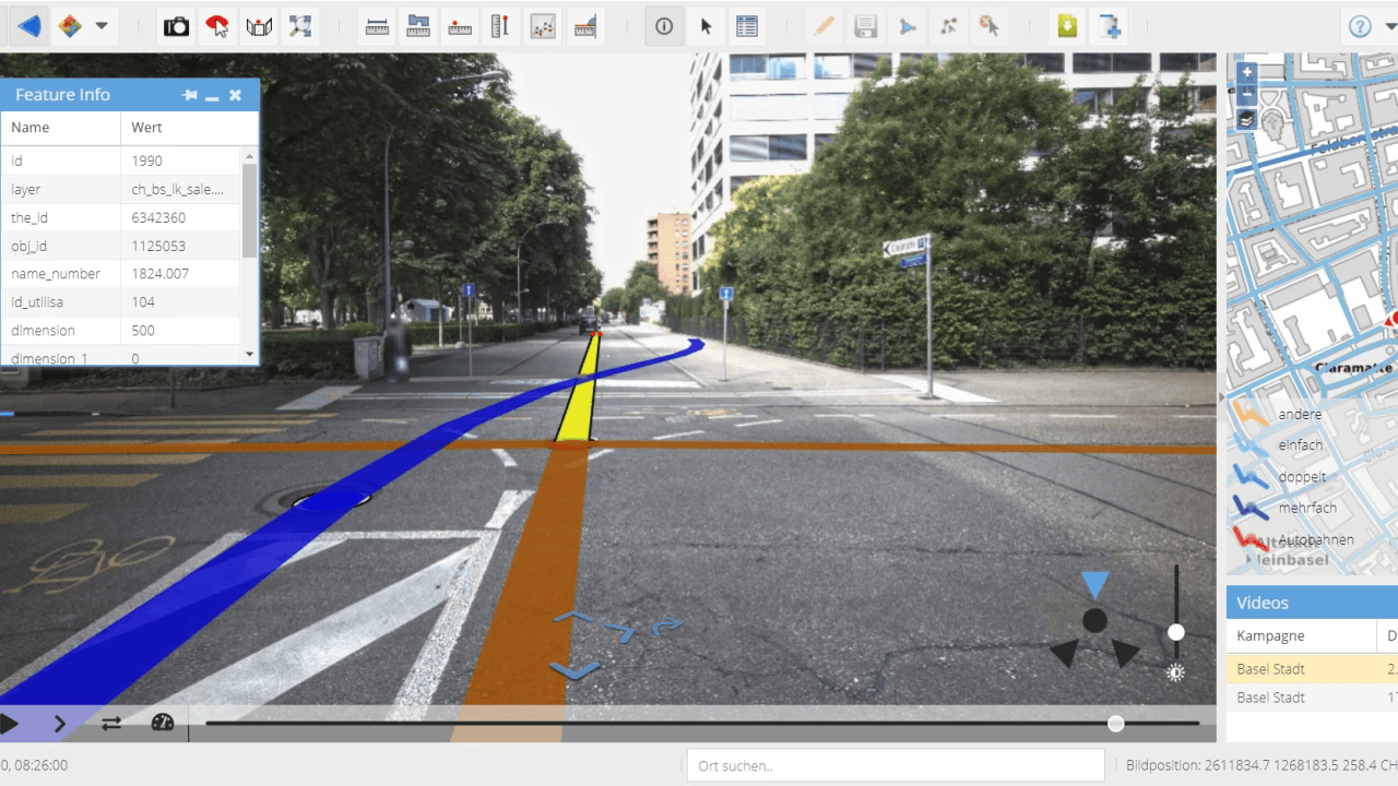
- Virtual field inspection
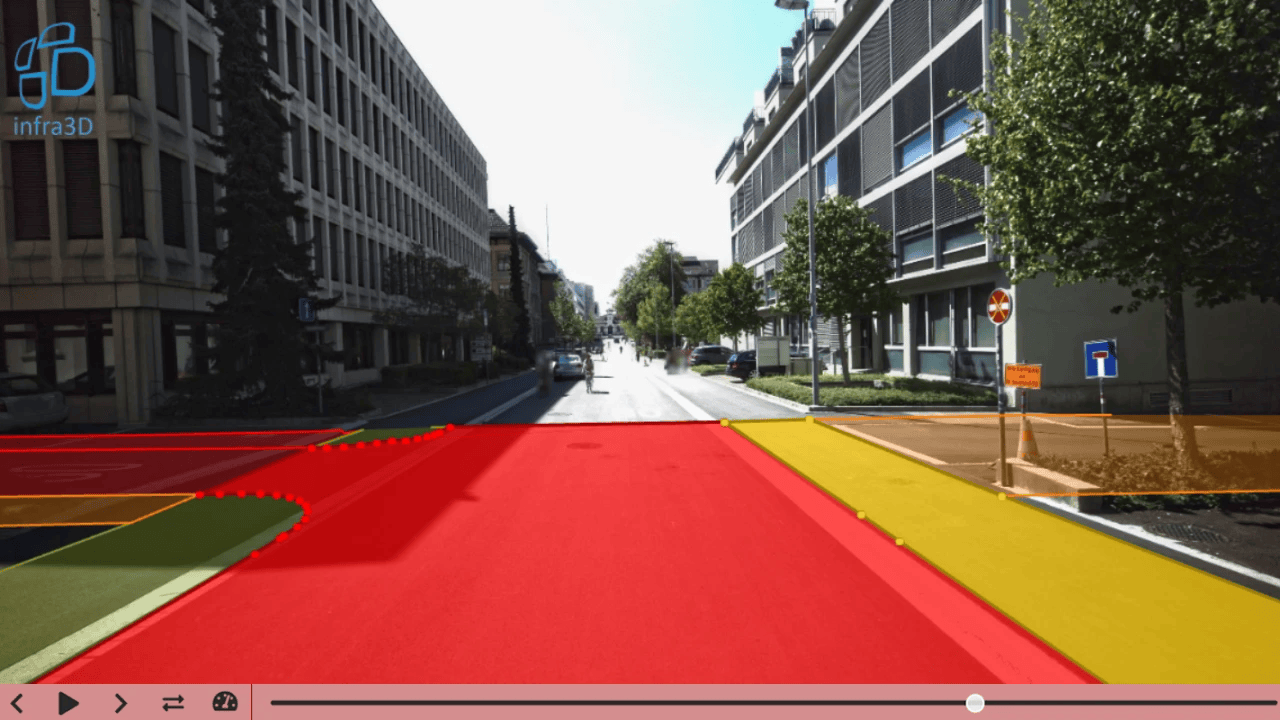
- 3D surveys and spatial analyses
- Capturing and visualisation of road conditions
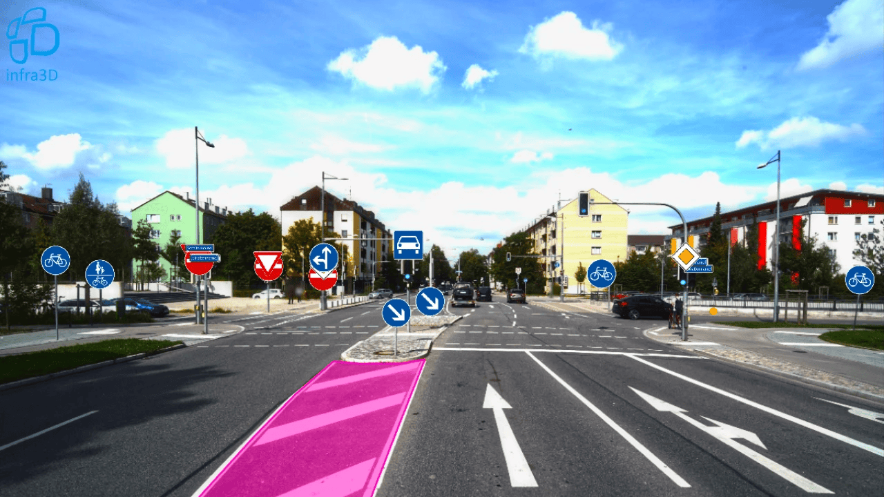
- Traffic signs and road markings
- Project planning and design data
- Mapping, inventory and visualisation of geoobjects
- Traffic safety analyses, etc.
With infra3D you can provide your digital road and rail to users via web browser as well as integrated in your geoinformation system. Geoinformation experts benefit especially from the extended functions. The opportunity arises to redesign various activities and processes in your organisation to your advantage.
Your advantages: Information gain and cost savings - Valuable information just a mouse click away
Images convey insights and information intuitively, quickly and richly in content. As a digital road in infra3D, this information increases long-term efficiency and work safety, among other things through fewer on-site inspections. infra3D simplifies infrastructure maintenance and management, as well as project planning and design work.
Interested in our innovative technology? Then visit us at the Smart Suisse exhibition stand 4.2 / S4. We look forward to your visit and the exciting exchange!
Further information: www.inovitas.ch